Bike Paths are paved facilities that are physically separated from roadways used by motor vehicles, by space or a physical barrier and designated for bicycle use.
Bicycle Network
Citywide Bicycle Map
Bikeway Map App
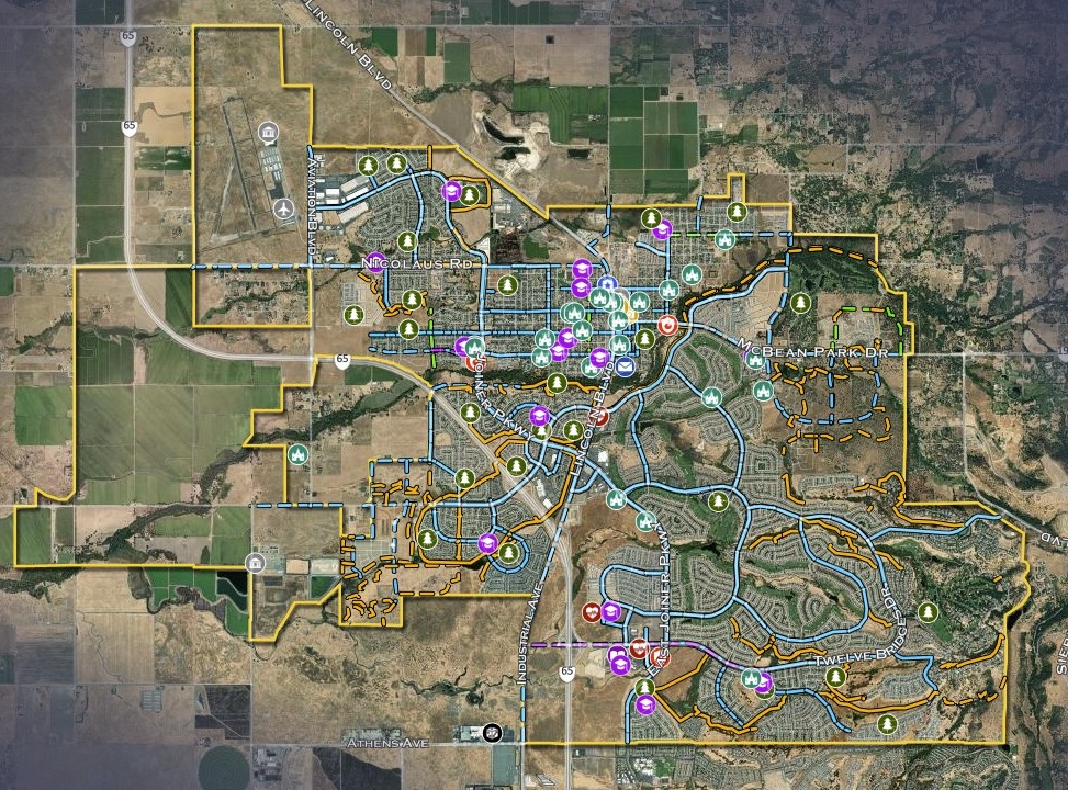
The City of Lincoln has an interactive Bikeway Map app! You may also download a PDF version of the Bikeway map.
Bikeway Classifications
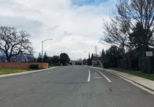
The City of Lincoln has many bicycle routes and bicycle lanes throughout the City. The Lincoln Bicycle Map is organized by Class I, Class II, Class III, and Class IV categories. Below are the definitions of each class:
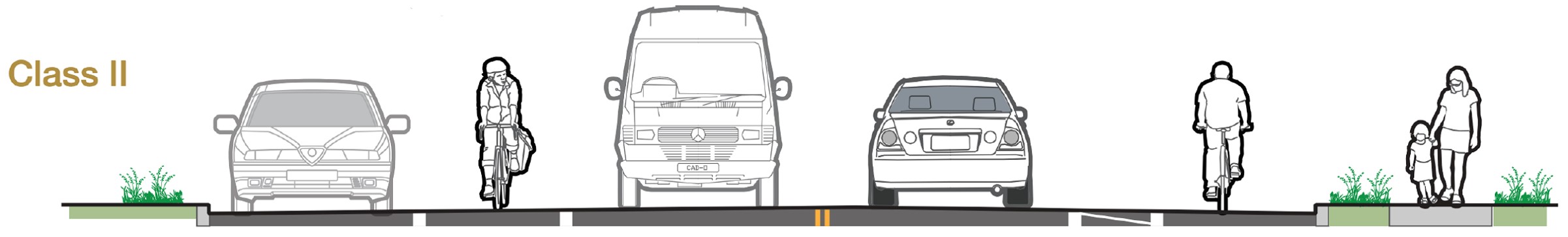
Bike Lanes are lanes on the outside edge of roadways reserved for the exclusive use of bicycles, and designated with special signing and pavement markings.
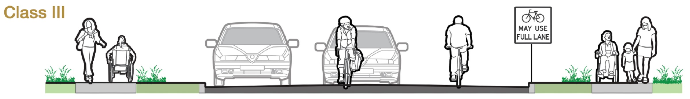
Bike Routes are roadways recommended for use by bicyclists, and often connect roadways with bike lanes and bike paths. Bike routes are designated with signs and/or shared lane markings (“sharrows”).
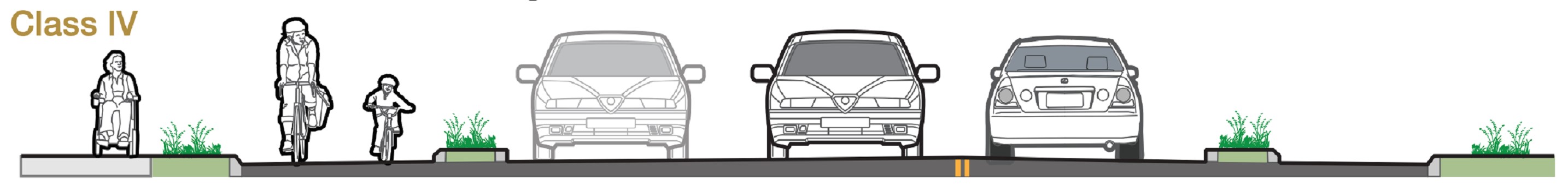
Class IV separated bikeways, often referred to as a cycle track or protected bike lanes, are for the exclusive use of bicycles, physically separated from motor traffic with a vertical feature. The separation may include, but is not limited to, grade separation, flexible posts, inflexible barriers, or on-street parking. Separated bikeways can provide for one-way or two-way travel.
Bicycle Improvement Projects
The City of Lincoln receives Local Transportation Funds (LTF) from the Placer County Transportation & Planning Agency (PCTPA) on an annual basis, based on City population. Two percent of the LTF funds must be used for bicycle and pedestrian improvements. The annual allotment for bicycle and pedestrian improvements from PCTPA varies, but is in the range of $50,000 per year. The City includes these funds in the annual Capital Improvement Project budget to carry out recommended projects in the City’s Bicycle Transportation Plan, as well as other bicycle and pedestrian needs that may arise.
Recently Completed Bicycle Improvement Projects
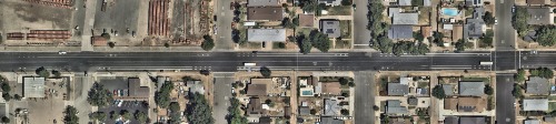
3rd & O Street Bicycle Lanes Project
- Location: 3rd Street from western terminus to D Street & O Street from Nicolaus Road to 1st Street
- Completed: Project was completed in 2018
- Improvements: The project installed over 3 miles of Class II bicycle lanes on 3rd and O Streets, connecting residential neighborhoods to McBean Park and several schools. Share the lane markings (“sharrows”) were installed in lieu of bicycle lanes in sections where the roadway was too narrow. Project cost: $78,000.
East Avenue Bicycle Lanes Project
- Location: East Avenue from McBean Park Drive to 9th Street
- Completed: Project was completed in 2019
- Improvements: The project installed 1 mile of Class II bicycle lanes on East Avenue. Share the lane markings (“sharrows”) were installed in lieu of bicycle lanes in sections where the roadway was too narrow. Project cost: $23,000.
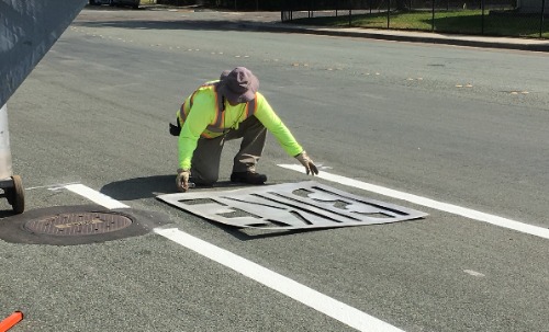
5th Street Bicycle Lanes Project
- Location: 5th Street from Joiner Parkway to Lincoln Boulevard
- Completed: Project was completed in 2020
- Improvements: The project installed 2 miles of Class II bicycle lanes on 5th Street. Share the lane markings (“sharrows”) were installed in lieu of bicycle lanes in sections where the roadway was too narrow. Project cost: $46,000.
1st Street Traffic Improvements Project
- Location: 1st Street between Fuller Lane and Joiner Parkway
- Completed: Project was completed in 2020
- Improvements: This project was implemented to improve public safety during pick up and drop off times in front of Creekside Oaks Elementary School on First Street. Poor circulation and minimal parking onsite created a situation whereby vehicles were making mid-block U-turns while parents and school children were crossing the street midblock.
- This project shifted the travel lanes to the south, eliminated parking on the south side of the street to prevent mid-block pedestrian crossings, and created a drive-through pick up and drop off zone on the north side of the street, protected by a vertical curb. Class II bicycle lanes were installed in both directions along the block. Project cost: $180,000.
5th & 7th Street Bicycle Lanes Project
- Location: 5th Street from Lincoln Boulevard to East Avenue & 7th Street from J Street to East Avenue
- Completed: Project was completed in 2022
- Improvements: The project installed nearly 1.5 miles of Class II bicycle lanes on 7th Street, providing access from residential neighborhoods to Lincoln High School, and nearly 1 mile of Class II bicycle lanes on 5th Street. Share the lane markings (“sharrows”) were installed in lieu of bicycle lanes in sections where the roadway was too narrow. Project cost: $37,000.
- Location: E. Joiner Parkway from Twelve Bridges Drive to the southern City limit
- Completed: Project was completed in 2023
- Improvements: The project widened East Joiner Parkway, from Twelve Bridges Drive to the southern city limit border with Rocklin, from two lanes to four lanes, installed a landscape median island along E. Joiner Parkway, and installed a roundabout at the intersection of E. Joiner Parkway and Fieldstone Drive. The project included installation of a traffic signal at the intersection of E. Joiner Parkway and Westview Drive and in front of Fire Station 35, infilled missing sidewalks and curb ramps, installed additional street lighting, and installed 2 miles of dedicated bicycle/NEV lanes. Project cost: $8.1M.
Upcoming Bicycle Improvement Projects
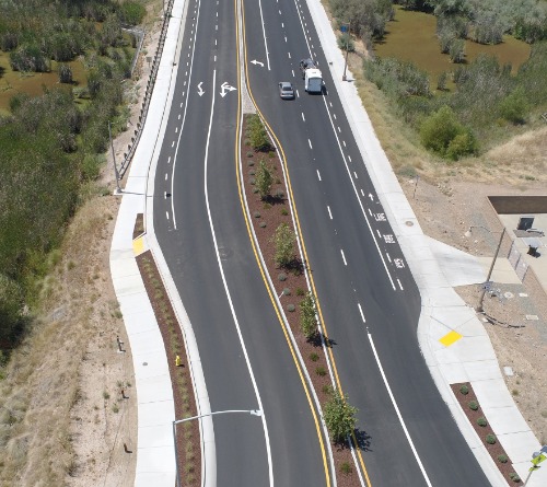
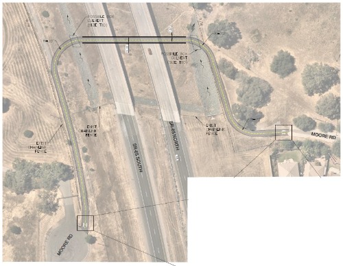
Moore Road Class 1 Trail Project
- Location: Moore Road at State Route 65
- Timeframe: The project is currently in the design phase. Construction is anticipated to begin in 2025.
- Improvements: This project will construct a Class 1 trail under a State Route 65 bridge adjacent to Auburn Ravine. When the State Route 65 bypass was constructed, Moore Road was bisected, creating dead ends on either side of the bypass. The project will re-establish the connection of Moore Road for cyclists and pedestrians.
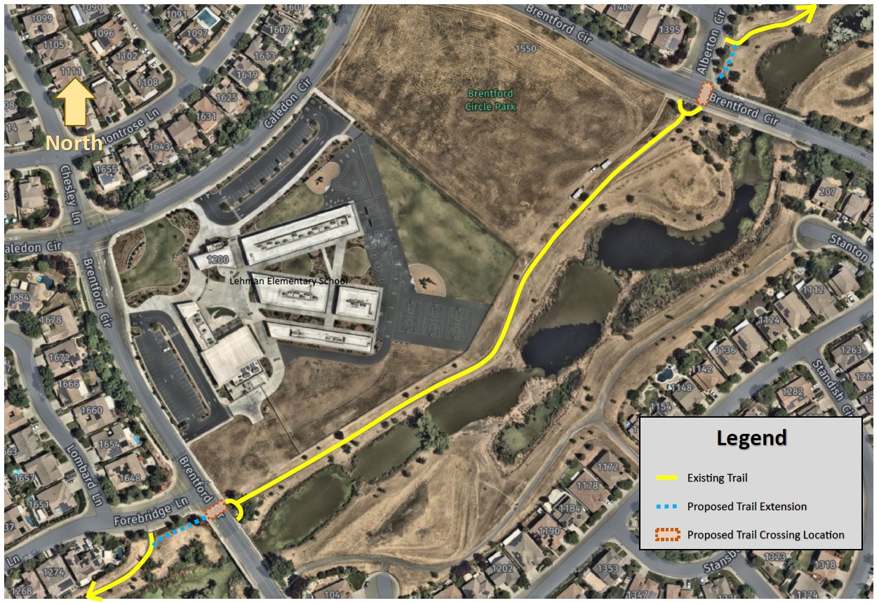
Brentford Circle Trail Crossings Project
- Location: Brentford Circle
- Timeframe: The project will begin design in early 2024. Construction is anticipated to begin in 2025.
- Improvements: One of the existing pedestrian and bicycle trails, that crosses through the Lincoln Crossing neighborhood, dead ends at Brentford Circle in two locations. This requires pedestrians and cyclists to traverse a significant distance along the sidewalk to safely cross at the nearest stop-controlled intersection. Most trail users do not travel to the nearest stop-controlled intersection and instead choose to cross Brentford Circle in a location without a crosswalk, proper pedestrian signage or sufficient curb ramps, creating an unsafe situation.
- With the recent construction of the Lehman Elementary School, next to the trail, many elementary aged children are now using the trail to get to and from school. The City is also working on plans to construct a neighborhood park in the vacant lot next to the elementary school which will create additional traffic along the trail.
- To create a safer environment for trail users, this project will install pedestrian crossings at the two locations on Brentford Circle. The project would extend the existing asphalt trails out to Brentford Circle, install ADA ramps, crosswalks, rectangular rapid flashing beacons (or similar), and post and cable fencing.
Contact Us
City of Lincoln
City Hall
600 6th Street
Lincoln, CA 95648
Phone: 916-434-2400
Email Us