McBean Park Drive Bridge Replacement
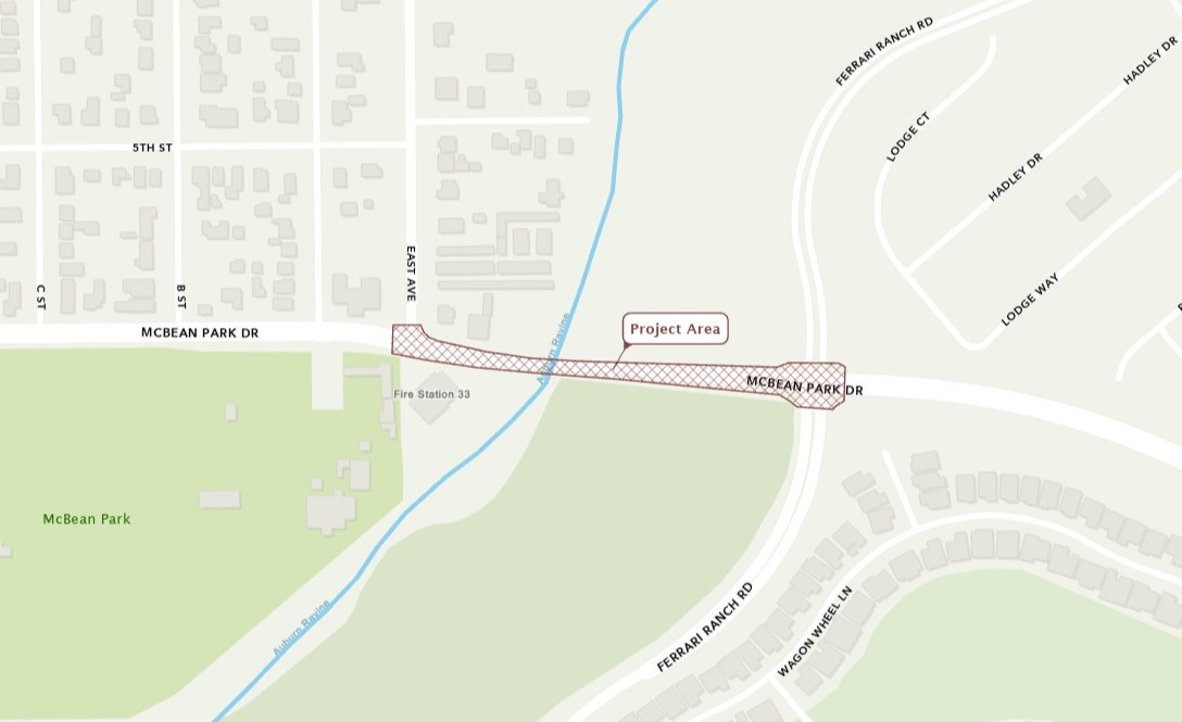
Project Area

Improvements
This project will replace the bridge and improve the roadway approaches on McBean Park Drive. The roadway and bridge currently flood during severe storms. This project will increase flood protection and limit impacts to nearby properties by:
- Raising the roadway profile
- Increasing the length of the bridge
- Include adherence to the Placer County Conservation Plan and Central Valley Flood Protection Board requirements.
The new bridge will also be widened to accommodate future traffic needs. The existing two-lane bridge will be replaced with a three-lane bridge. This will include:
- Wide shoulders to serve as Neighborhood Electric Vehicles (NEV) and bicycle lanes
- Pedestrian outlook facing south placed mid-span of the new bridge
- Sidewalks for pedestrians.
The bridge's appearance will also be enhanced to provide an attractive entrance to downtown Lincoln.
Design
The City hosted an informational community open house for this project on June 21, 2016. A brief presentation outlined the preliminary design, funding, schedule, and construction impacts. The community voted for their favorite aesthetic design concept and the Local Heritage Concept was selected.
Time Frame
Construction is scheduled to begin in 2025 with estimated completion in 2027.
Initial Study / Mitigated Negative Declaration
- Public review period of the Initial Study / Mitigated Negative Declaration ended July 11, 2023. Thank you for your input!
- The Mitigated Negative Declaration was approved by the City Council of the City of Lincoln at the August 22, 2023 meeting.
Environmental Public Notice
Notice of Intent to Adopt U.S. Department of Transportation Section 4(f) De Minimis Finding for Impacts to the McBean Park Preserve and the Auburn Ravine Natural Preservation Area public review period ended Friday, December 14, 2023.
Contact Chris Carroll, Environmental Scientist, at (530) 720-5583 for more information about the project.
FAQ
Why does the Bridge need to be replaced? |
|
The Bridge is over 100 years old and needs replacing to reduce flooding potential and overtopping of the Bridge. The roadway currently overtops in a 10-year flood event and the bridge overtops in a 25-year event. Replacing this bridge will reduce the potential for flooding of adjacent private properties. |
Will the Bridge be larger when completed? |
|
The existing bridge is approximately 150 feet long and two lanes wide. The new bridge will be approximately 210 feet long and three lanes wide. Total bridge width is increasing from 43 feet to the new bridge width of 70 feet. The larger bridge allows more water to flow under the bridge without overtopping. It will also improve traffic flow and turning movements into and from downtown. The bridge will also have access for NEV's, pedestrians and bicycles. Concrete barriers will separate the new sidewalks on each side of the bridge from the shoulders and travel lanes. |
Will the Bridge/road close during construction? How will this affect traffic? |
|
The project team is developing a phased construction approach that will seek to keep one lane of traffic open in each direction during construction. |
How is this project funded? |
|
Funding for the project is a combination of:
|


